STEP BY STEP BY STEP…
Being an essential means of demonstrating the “effective occupation” demanded by other European powers, border photographs show the difficult progress through the interior of the territories and document, step by step, the different phases of geodetic work, such as building towers or using tall trees to ensure the inter-visibility between the points to be demarcated, trimming lines in the forests to measure the designated “base”, and installing temporary pyramids until the final decision about the exact location of the landmark and its very construction.
In parallel, the images testify to the colonial situation using hundreds of black porters charged with all the heavy work resulting from the compulsory labour legislation. Village chiefs were intimidated into providing this workforce. Therefore, written reports describe frequent escapes and forms of evasion of Africans, as well as numerous episodes of aggression against them. These aspects were naturalised and devalued by the colonial authorities of the time.
SLIDE SHOW
Delimitation Commission of the Angola Southeastern Border - First part of the works. 1912-1914
Digital positives from original glass negatives on gelatin and silver, 9x12cm.
Photograph by Carlos Viegas Gago Coutinho [attrib.]
© Photographic Collection IICT - MGG
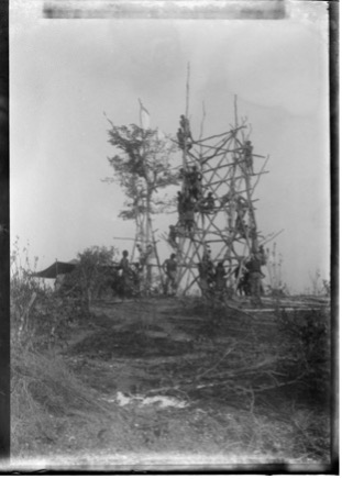
Construction of towers to secure intervisibility between the triangulation points.
M'Kumbuíra tower (former 12 Durão milestone). [Original caption] [Under construction].
Border demarcation of the district of Tete - South of the Zambezi, 1904-1906.
Photograph by Carlos Viegas Gago Coutinho [attrib.]
Reproduction of original glass negative on gelatin and silver, 9x12cm.
© UL/IICT-CCart Photographic Collection 23859
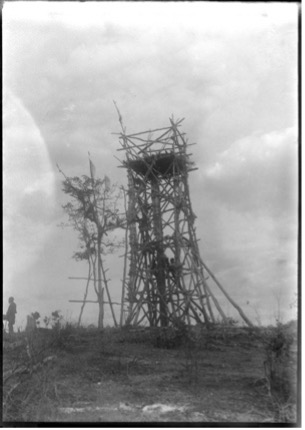
M'Kumbuíra tower (former 12 Durão milestone). [Original caption] [After construction].
Boundary demarcation of the district of Tete - South of the Zambezi, 1904-1906.
Photograph by Carlos Viegas Gago Coutinho [attrib.]
Reproduction of original glass negative on gelatin and silver, 9x12cm.
© UL/IICT-CCart Photographic Collection 24632
Both the monarchical and republican regimes were promoters of the colonial system.
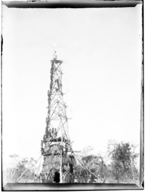
Geodesic Mission to East Africa, 1907-1910.
Punguka Tower No. 98 20 m. [Original caption]
Photograph by Carlos Viegas Gago Coutinho [attrib.]
Reproduction of original glass negative on gelatin and silver, 9x12cm.
© UL/IICT-CCart Photographic Collection 24107
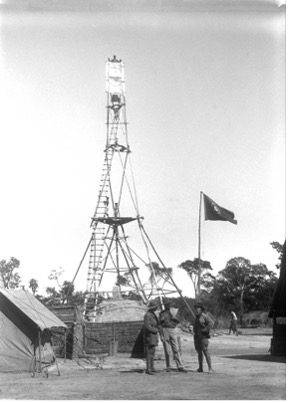
Commission for the demarcation of the Southeastern border of Angola, 1st part of the works, 1912-1914.
Mukanga Tower. March 1903. [Original caption]
Photograph by Carlos Viegas Gago Coutinho [attrib.]
Reproduction of original glass negative on gelatin and silver, 9x12cm
© UL/IICT-CCart Photographic Collection 24229
Theodolites were used for measuring angles and calculating distances between intervisible points. Temporary pyramids mark geolocated points.
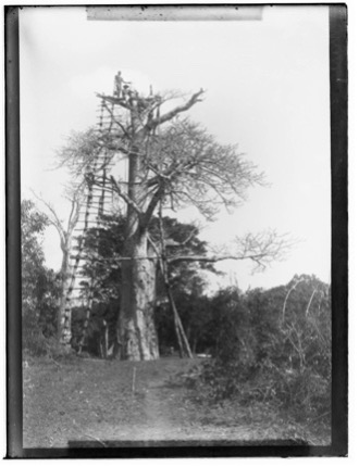
Geodetic Mission to East Africa, 1907-1910.
[Tower adapted from a baobab tree]
Photography by Carlos Viegas Gago Coutinho [attributed]
Reproduction of original glass negative on gelatine and silver, 9x12cm.
© UL/IICT-CCart Photo Collection 24037
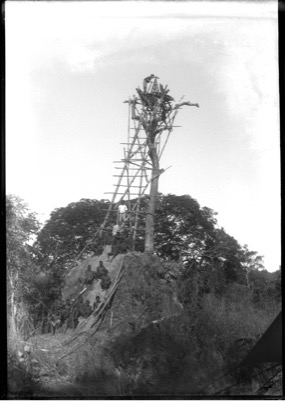
Demarcation of the Southeastern border of Angola. 1st part of the works, 1912-1914.
Marco IV Station. [Original caption]
Reproduction of original glass negative on gelatin and silver, 9x12cm.
© Photographic Collection UL/IICT-CCart 24381
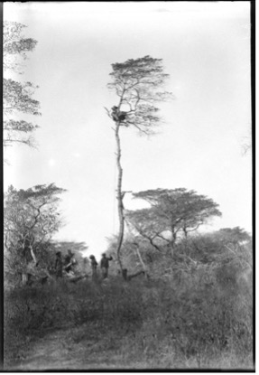
Coutinho observing [Original caption].
Geodesic Mission to East Africa, 1907-1910.
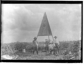
Mark. May 1909 [Original caption].
Geodesic Mission to East Africa, 1907-1910.
Photographs by Carlos Viegas Gago Coutinho [attrib.]
Reproduction of original glass negative on gelatin and silver, 9x12cm.
© Photographic Collection UL/IICT-CCart 25128 and 24066
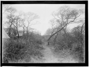
In order to know the distance between two points, paths were drawn in the bush, which began to be measured using wires made of ínvar, a metal alloy with little expansion, suitable for tropical climates.
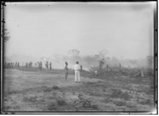
[A burning].
Dilolo's Luso-Belgian Border Delimitation Commission, 1914-1915.
Photograph by António Alberto or Joaquim da Fonseca e Costa.
Reproduction of original glass negative on gelatin and silver, 13x18cm.
© UL/IICT-MGG Photographic Collection 25309
 .
. 
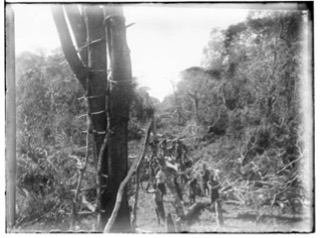
Clearing a path through the forest.
Geodesic Mission to East Africa, 1907-1910.
July 1908. Alignment of Manhiça.
Geodesic Mission to East Africa, 1907-1910.
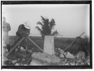
Reading [Invar's] thread. [Original captions]
Geodesic Mission to East Africa, 1907-1910.
Photographs by Carlos Viegas Gago Coutinho [attrib.]
Reproduction of original glass negatives on gelatin and silver, 9x12cm.
©UL/IICT-CCart Photographic Collection 24016, 23990 e 23982.
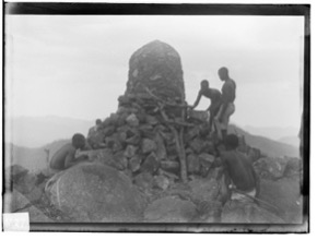
Once the points between the European forces were decided, the landmarks were built and taxes collected with greater certainty from the local populations whose nations were cut by these lines.
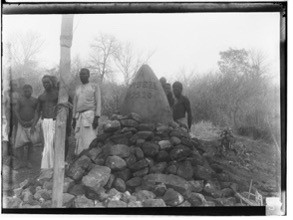 .
. 
Landmark I - Luangua Meridian (Seen from W.) [Original caption]
Border demarcation Commission of the Tete district - South of the Zambezi, 1904-1906.
Landmark XXVII - Manguiro (Seen from SW.). [Original caption]
Border demarcation Commission of the Tete district - South of the Zambezi, 1904-1906.
Photographs by Carlos Viegas Gago Coutinho [attrib.]
Reproduction of original glass negative on gelatin and silver, 9x12cm.
© UL/IICT-CCart Photographic Collection 23848, 23909
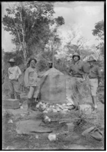
Landmark L5. [Original caption]
Commission for the demarcation of the Southeastern border of Angola, 1st part of the work, 1912-1914.
[Recognized in the foreground: Gago Coutinho, Major Gordon and Costa Santos].
Photograph by Carlos Viegas Gago Coutinho [attrib.]
Reproduction of original glass negative on gelatin and silver, 9x12cm.
© UL/IICT-CCart Photographic Collection 24597
MEASURING/DOMINATING THE TERRITORY
Border photographs are also important sources for the history of geodesy. This science defines and implements representative coordinate systems of the Earth's surface and measures it in time and space, the basis of cartography.
These methods were able to obtain maps of great accuracy. The application of photography to aerial photogrammetry is the basis of contemporary precision cartography for civil and, mainly, military uses.